Local Trail - Merimbula Tip Trail
Trail Difficulty: Moderate
Merimbula Tip Trail
Getting there
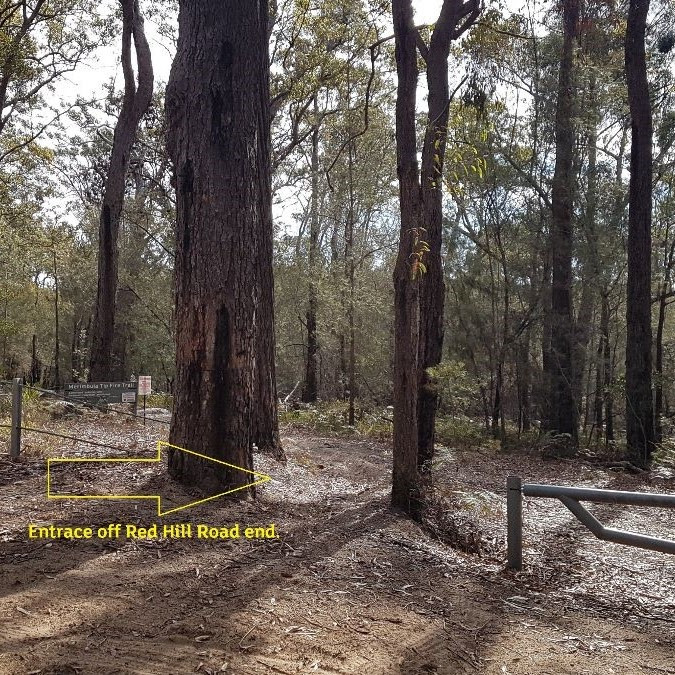
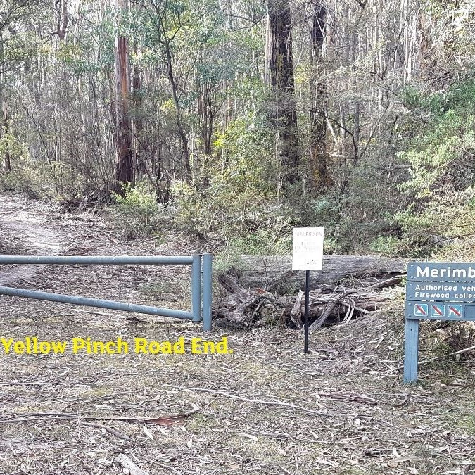
The track starts on Red Hill Road Tura Beach (off Sapphire Coast Drive) just down from the Merimbula Tip entrance. The track will exit just off the Princes Highway at the end of Yellow Pinch Drive.
The track
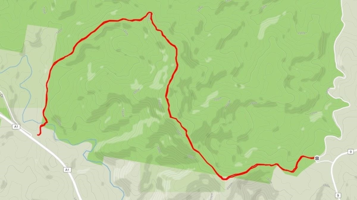
The trail starts near the Merimbula tip entrance at the top of Red Hill Road. There is a gate with a clear sign.
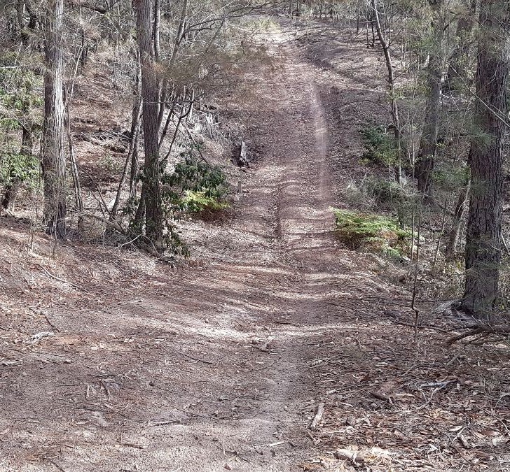
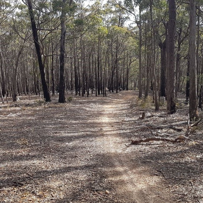
The first 750m follows around the back of the tip; undulating – including one short, steep dip early on and a short climb to the first intersection at 1.25km.
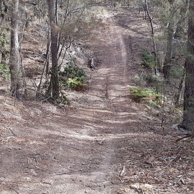
At approximately 1.25km from the start (gate) there is an intersection; keep right here, as the left trail will take you via a very steep hill (called MSG Hill), which leads to Merimbula Drive next to Merimbula Sand & Gravel (MSG).
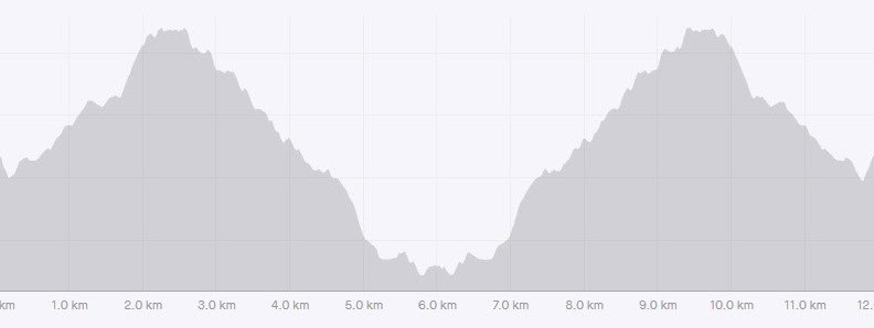
Trail continues along the ridgeline, mostly gently undulating, but more downhill than uphill.
At 5.75km there is a gate and at 5.8km a creek crossing (dry in dry weather).
The end (or start) of the tip trail is at 6km, where you reach the bitumen remains of the old highway (Yellow Pinch Drive).
Difficulty
Moderate – Undulating with some steeper sections – Some sections of the fire trail are smooth and flowy, whilst others can be (weather dependant) dry and sandy with loose and exposed rocks. It is all through eucalypt forest, which is very nice – even if you generally can’t see out beyond the forest. It is an out and back run (or one way, if you have transport). There are also a few minor single tracks that come off the fire trail (mentioned below in the notes).
The distance one way is 6km or return to the start being 12km.
Connections
At approximately 1.25km from the start (gate) there is an intersection to the left, the trail will take you via a very steep hill (called MSG Hill), which leads to Merimbula Drive next to Merimbula Sand & Gravel (MSG).
There is an indistinct side-track off to the right at 2.05km called ‘Little creatures’ which meets up with Red Hill Rd, making a 7.35km loop option.
There is another indistinct side-track off to the left and over some rocks at 2.54km, ‘To the Wall’ which goes predominantly downhill and re-joins the tip trail further along at approx. 5.45km mark of the tip trail. Both ‘little creatures’ and ‘to the wall’ entrances are hard to see and very easy to miss.
Continuing along the tip trail, the next side-track off to the right is at 3.38km called ‘Tooheys New’. This also meets up with Red Hill Rd, making a 9.4km loop (It also intersects with Little Creatures close to Red Hill Rd).
At approximately 3.7km, the tip trail curves left steeply downhill off the ridge (At this point there is an optional side-track off to the right into ‘Deliverance Country’ [which also links to other tracks and which adds another extended loop option], returning to the tip trail near the end at approx. the 5.65km).
Continuing along the tip trail, the next side-track to the left at 5.45km is the exit of ‘To the Wall’, and another side-track to the right at 5.65km is the optional exit of ‘Deliverance Country’. Both of these are very indistinct and can be easily missed.
Back to all Trails
Please Wait, Processing Submission.
Do not refresh or leave this page until loading complete.